
Elevation Certificate Support for Flash Flood Areas
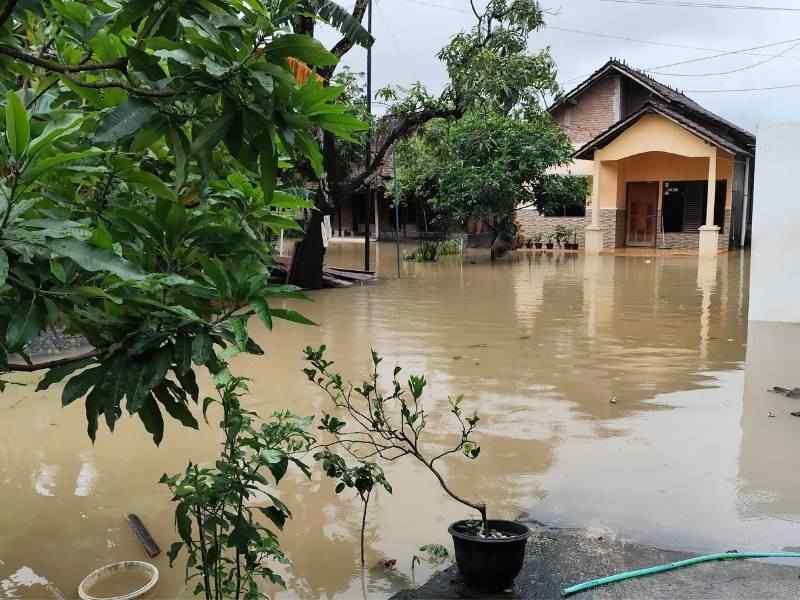
Flash floods give almost no warning. Water rises fast in low spots, and a foot of building height can decide how a property fares. An elevation certificate captures that height in a formal record. It matters most in areas where sudden flooding is a real concern. The document lists key measurements about how high a structure sits. Those numbers come from a surveyor’s field work, not a rough guess. When water moves fast and stakes run high, that record gives owners something solid to stand on. It answers the height question before anyone needs the answer in a hurry.
Documenting Structure Elevation in Fast Runoff Zones
In areas where runoff builds fast, exact building height carries real weight. An elevation certificate records where a structure sits against key reference points. The numbers reflect measured fact, not estimate. A surveyor gathers them on site, which gives the document its credibility.
Fast runoff zones leave little room for vague information. An owner who knows the certified height of a finished floor understands far more about the building’s flood exposure. Someone working from guesswork knows far less. Recording those elevations creates a clear, dependable snapshot of the structure. That snapshot holds up whenever a question about height comes along. It stays valid until the building or the ground around it changes.
Helping Owners Respond to Flood Documentation Requests
Owners in flood-prone areas often face requests for elevation records, sometimes on short notice. Lenders, insurers, permit offices and property reviewers may all ask for proof of how high a structure sits. An elevation certificate answers those requests with one recognized document. There is no scramble for scattered paperwork.
Having that record ready saves stress and time. When a request lands, an owner who already holds a current certificate simply hands it over. The loan, policy or permit keeps moving. Owners without one often face delays while they arrange a survey under pressure. The timing tends to hurt at exactly the wrong moment. A ready record removes that pressure entirely.
Supporting Property Decisions After Heavy Rain Concerns
A string of heavy storms tends to raise hard questions about a property’s future. Owners and buyers start to wonder how the structure handles water. They wonder whether its height offers any margin during a flood. Elevation certificate information helps ground those worries in measured facts rather than fear.
The document gives both sides of a possible sale something concrete to weigh. A buyer can see how a home sits against flood reference points. An owner can point to real numbers instead of vague reassurance. That shared, measured basis makes flood-related conversations calmer and more honest.
The record also helps an owner plan improvements with open eyes. Someone weighing an addition can see how the current floor sits first. That number shapes smarter choices about height and design. It turns a worried guess into a clear starting point.
Updating Records When Site Conditions Have Changed
A certificate reflects a property as it stood on the day of the survey. Properties change. Grading work, an added room, foundation repairs or a lost original file can all make an old certificate unreliable. When any of those happen, updated documentation keeps the record matching the real structure.
Owners sometimes overlook how much small changes shift the picture. Raising a floor during a remodel can alter how a building relates to flood reference points. So can reshaping the yard during landscaping. Refreshing the certificate after such work keeps the paperwork honest. It also prevents confusion the next time someone reviews the property.
A current certificate saves money in the long run. An outdated one can trigger extra reviews or delays. Keeping the record fresh means fewer snags when a lender or insurer asks for it. The small effort of an update pays off later.
Giving Flood Reviewers Measured Information
Reviewers who handle flood matters prefer measured data over visual judgment. A certificate delivers exactly that. Certified elevation figures let them base decisions on a surveyor’s field work instead of a guess about how high a building looks. That precision improves the quality of every review that relies on it.
Measured information also keeps different reviewers on the same page. A lender, an insurer and a permit office might all read from the same certified numbers. Their conclusions then rest on one consistent source. That shared accuracy cuts down on disputes. It also speeds up the decisions that depend on a building’s true height.
That consistency matters more in a fast-moving situation. After a big storm, requests can pile up quickly. A certified document answers each one the same way. Reviewers spend their time deciding, not debating whose numbers to trust.
Frequently Asked Questions
Why is an elevation certificate helpful in flash flood areas?
It records certified building height in places where water can rise fast. That gives owners measured facts for flood-related property matters instead of rough estimates. That measured basis carries weight with everyone who reviews the property.
Can an elevation certificate help after a property is flagged for flood risk?
Yes. It supplies measured height information that lenders, insurers or local offices can review once a property draws flood-related attention.
Does an elevation certificate predict flooding?
No. It documents building height only. Flood risk decisions also draw on maps, local rules and professional judgment beyond the certificate itself.
When should elevation records be updated?
Update them when the original is missing, out of date or no longer matches the property after grading, additions or repairs.