
Topographic Survey Data for Designing Around Natural Drainage Corridors
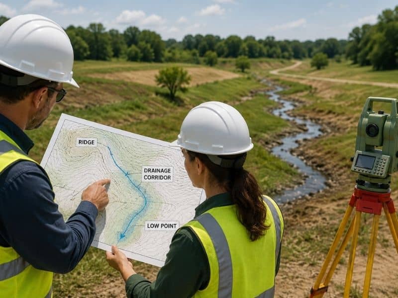
Every tract of land has a natural way of shedding water, even when no ditch or pipe is in sight. A topographic survey brings that hidden pattern into full view. It measures the high points, the low points, and every dip in between, so engineers can design around water instead of fighting it later. Skipping this step often means finding out about a drainage corridor the hard way, after grading has already begun.
Natural drainage does not care about property lines or building plans. It follows the shape of the land. Understanding that shape early gives a project team a real head start.
Defining the High and Low Points Across the Tract
Spot elevations and contour lines together tell the full story of how a piece of land drains. High points shed water outward, while low points collect it. Seeing both laid out on one map lets an engineer trace the overall pattern before any lots or streets get drawn.
This picture often looks different from what a simple walk across the land would suggest. A gentle looking field can still funnel a surprising amount of water toward one corner during a storm. Careful measurement catches this kind of pattern well before it becomes a costly surprise.
Mapping Channels That Carry Water Without Formal Structures
Not every drainage path has a ditch or a pipe built for it. Swales, shallow draws, and old creek paths can carry real water during storms even though they look like ordinary ground the rest of the year. These natural channels need to be found and mapped just like any built structure.
A channel that runs dry most months can still shape how a whole tract needs to be graded. Marking these paths clearly gives the design team a true picture of where water already wants to go, rather than relying on guesswork about how the land behaves.
Locating Crossings That May Interrupt the Flow
Roads, driveways, fences, and small culverts often cross these natural channels, and each crossing can change how water moves through the site. A driveway built without enough clearance can back water up during a heavy storm, sending it somewhere it was never meant to go.
Recording where these crossings sit, and how they interact with the channel beneath them, helps an engineer decide whether a crossing needs to be upsized, replaced, or simply left as it is. Ignoring these small structures during design can lead to real flooding problems later.
Measuring the Relationship Between Drainage and Proposed Lots
Once the drainage pattern is mapped, it gets compared against the layout of proposed building pads, streets, and open space. This step shows where a lot might sit too close to a natural channel, or where a street could end up blocking water that needs a clear path through the site.
Placing lots and drainage corridors on the same map, rather than reviewing them separately, catches conflicts early. A design that respects the land’s natural drainage tends to face far fewer problems once construction and heavy rain both arrive.
Creating the Existing Surface for Hydraulic Analysis
All of this field data eventually becomes one digital surface model, and engineers use that model to run the calculations behind a stormwater design. Flow rates, channel capacity, and detention needs all depend on having an accurate picture of the land as it exists today.
A hydraulic model built on rough or guessed terrain data can miss real drainage risks. Starting from a measured survey gives the engineer confidence that the numbers behind the design actually reflect how water moves across the site.
Frequently Asked Questions
Can a dry channel still be an important drainage feature?
Yes. A channel that looks dry most of the year can still carry a large amount of water during storms, so it needs to be mapped carefully.
Does the survey establish the legal floodplain?
It can support flood studies, but official floodplain lines depend on the right maps, studies, and government authorities.
Are nearby upstream areas relevant?
Yes. Water from land outside the property can still enter the site, so upstream conditions often matter for the overall drainage picture.